Field visit and modelling approach
From 13th to 30th June 2022, Dr. Eric Koomson visited several SustainSahel field sites in Mali (IPR/IFRA), Senegal (CSE) and Burkina Faso (Universite Nazi Boni). The aim of the visit was to gain understanding of their ongoing field trials, farming systems and to strengthen collaboration with partners through addressing mutual expectations, knowledge sharing and access to data.
Field research activities are currently ongoing and focused on thorough characterization and analysis of landscapes using remote sensing techniques (by CSE, Senegal) to identify existing CSL systems, and to derive base maps, spatial distribution of soil, vegetation types and farming systems. The spatial maps together with weather data (rainfall, air temperature, solar radiation etc.) measured by University of Kassel and Hohenheim installed sensors, and agronomic data on management practices are being used as baseline data to parameterize the land use change impact assessment model (LUCIA, see weblinks below) and livestock simulator model (LIVSIM, see weblinks below) coupled ensemble.
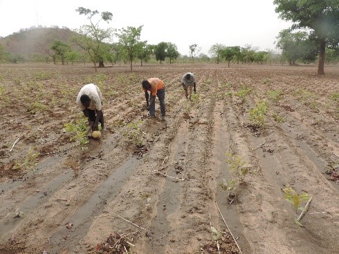
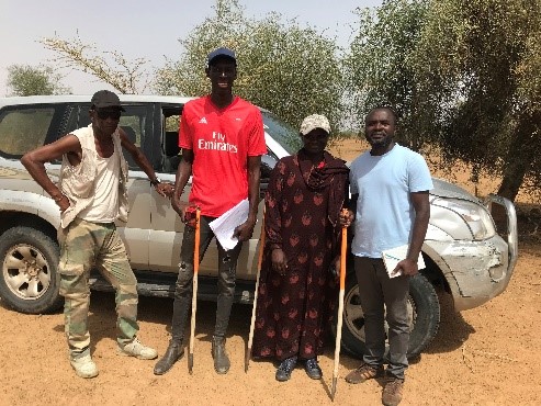
Observation trials on farmer fields in Koulikoro, Mali (Image 1) are ongoing to detail land preparations, manure applications, planting etc., and updating the land use maps in Dahra, Senegal (Image 2) as input layer for LUCIA to characterise the CSL systems. The visit also served to identify complementarities and direct benefits of the modelling activities for SustainSahel's research partners. Challenges associated with field practices were discussed with local partners and feedback will be used to improve plausibility of model parameterization.
Model scenarios and simulations
Model scenarios for Niakhar, Senegal and Saria, Burkina Faso describing the current land use practices and challenges have been developed. The scenarios were developed from MARP reports by WP2 and potential needs were discussed with local partners. Alternative scenarios on land uses and cropping systems will be simulated for up to 20 years to assess the potential for:
- soil fertility decline,
- soil and tree/shrub C stock dynamics, and
- crop performance.
Model outputs will aim to derive land use recommendations for local stakeholders.
Further information
Written by: Eric Koomson, Research assistant at University of Hohenheim, Germany (UHOH)
Weblinks
- lucia.uni-hohenheim.de: LUCIA - Land Use Change Impact Assessment tool
- models.pps.wur.nl/livsim: LivSim - Livestock Simulator Model


 tap and then scroll down to the Add to Home Screen command.