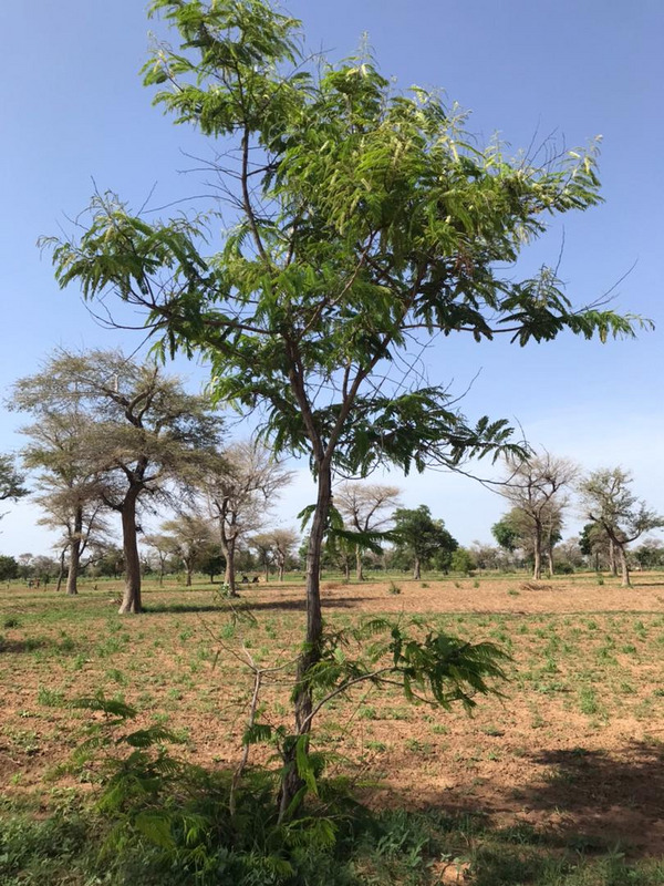
The agroforestry systems in the west Africa Sahel, popularly known as parklands, present a myriad of complexities that are spatially heterogeneous, especially at the landscape level (Fig 1). The complexities of these systems lie in soil - the diversity of roots, i.e. the differences in rooting volume, architecture and canopy structures of competing species (trees, shrubs and crops), up and down soil water movements, competition for water and nutrients, etc.
Models thus must be adapted to provide a good representation of these systems and their interactions to, for instance, account for the spatial variability. This will help to address parkland influence on crops. At the same time, models should be as simple as possible to reduce required user inputs which are often difficult to obtain.
LUCIA model
The land use change impact assessment model (LUCIA) is a spatially explicit and grid–based landscape model that runs on a daily time schedule. LUCIA simulates plant productivity, soil fertility and degradation of small watersheds, regarding agricultural production and ecosystem services, such as erosion protection, water retention and carbon storage (Marohn and Cadisch, 2011). LUCIA handles variable landscape size and pixel resolutions, which allows simulating agroforestry (AF) systems and savanna rangelands with their heterogeneity in soil, vegetation, and topography. Some possible way to improve the model:
Multilayer soils
In its original version, LUCIA allowed the parameterization of two soil horizons only. In order to more adequately represent water and nutrient availability and movements in the soil profile in dryland areas new python routines in the main script (lucia.py) have been added to allow for any user defined layer numbers and thickness (cm). Corresponding input file formats have been created for soil properties (soil.lut), initial surface and soil litter (litterini.lut), and soil organic matter fractions (lusom.lut) to allow user external parameterisation.
Improved soil water and leaching routine
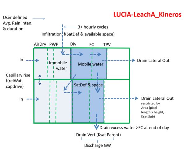
Further improvements in soil water movement and leaching have been included in LUCIA according to the LeachA concept of Hutson and Wagnet (1993) in which soil water is divided into mobile and immobile phases (Figure 2). The division between mobile/immobile water is assumed to be the water content corresponding to a defined matric potential. After rainfall, percolation (infiltration) of water and dissolved solutes (e.g. nutrients) is allowed in the mobile phase only. After removing evapotranspiration and plant water uptake, equilibration between adjacent segments is driven by differences in water content rather than water potential, and mobile and immobile phases within segments are assumed to reach equilibrium each day. This allows an improved description of percolation/leaching processes without extensive input requirements.
Written by: Eric Koomson, Research assistant at University of Hohenheim, Germany (UHOH)
Further information
Weblinks
lucia.uni-hohenheim.de: LUCIA - Land Use Change Impact Assessment tool


 tap and then scroll down to the Add to Home Screen command.